Place guide
Big Tubes Area
A remote, permit-only area of El Malpais National Monument reached by rough road, with the monument's largest lava tube caves and collapsed lava trenches.
📍GPS: 34.944797, -108.104109
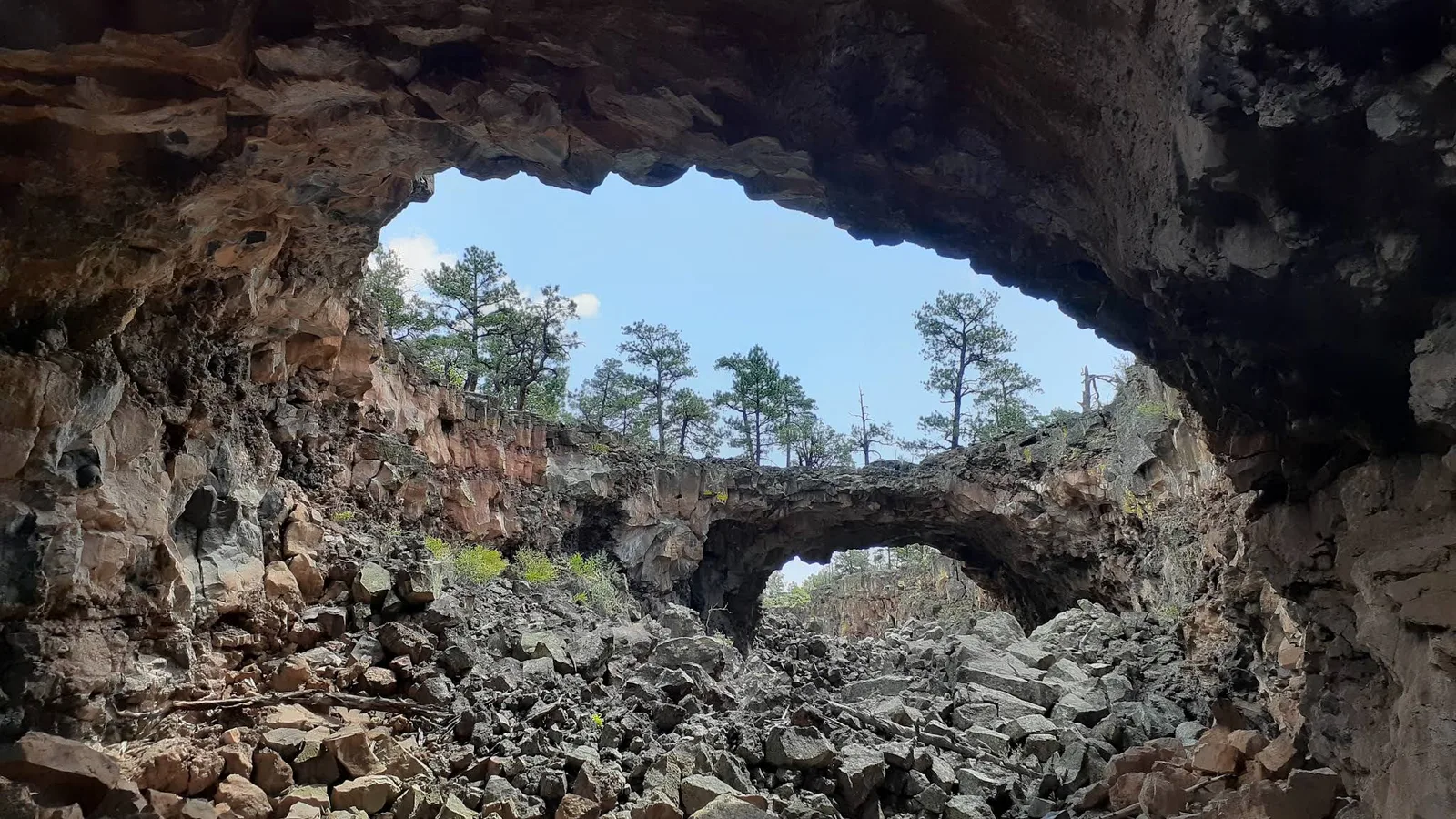
Big Tubes is a remote lava-tube area in El Malpais National Monument. Reaching it takes a rough drive followed by a cross-country hike over broken basalt, but the payoff is access to some of the monument’s largest lava-tube features. Popular formations include Big Skylight Cave, Four Windows Cave, Caterpillar Collapse, and Seven Bridges, all spread across a rugged section of the lava flow.
What to Do
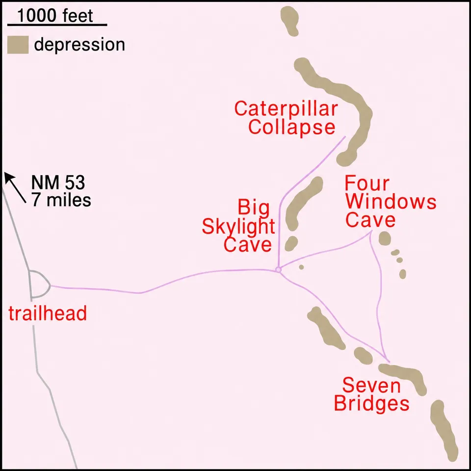
A cairned route, roughly two miles in a rough figure-8, links the main features: Big Skylight Cave (enter just north of the trail junction, where a circular roof opening drops light onto a floor of broken lava blocks), Four Windows Cave (named for the four skylights punched through its ceiling), and the collapsed sections at Caterpillar and Seven Bridges. None of the caves have stairs, railings, or lighting. Before you go, pick up a free caving permit in person at El Malpais or El Morro visitor center. Bring a helmet and at least two independent light sources (headlamps, not phones), plus kneepads and gloves if you plan to actually enter the tubes. All lava tube caves in the monument close November 1 through April 30 to protect hibernating bats, so this is strictly a warm-season destination.
How Much Time to Spend
Plan on a half day. Between the drive from Grants, the rough final approach, and picking your way across lava to reach and explore two or three caves, figure two to four hours minimum once you’re on site. This isn’t a place to rush.
Getting There
From NM 53 south of Grants, turn onto County Road 42, then follow the Big Tubes Road (NPS Route 300) about 4.5 miles to the parking area. High-clearance and four-wheel drive are strongly recommended. The road washes out and becomes impassable during winter snow and again during the late-July-to-August monsoon, so it’s worth calling the visitor center to check conditions first. There’s no cell signal and no marked trail once you leave the parking area, just cairns across sharp, uneven lava, so make sure you come prepared.
This isn’t a casual stop on a road trip. If you want a first look at El Malpais’s lava tubes without the permit process and rough drive, start at El Calderon instead. Save this for when you’re ready to commit a half day to the most adventurous part of the monument.
Nearby places
Ice Cave and Bandera Volcano
A privately run attraction at the base of Bandera Volcano featuring a year-round ice-filled lava tube in the Malpais lava fields.
El Calderon
A volcanic cinder cone in El Malpais National Monument surrounded by lava flows, a bat colony, and ponderosa forest.
Grants
A Route 66 town once known as the uranium capital of the world, gateway to El Malpais.