Place guide
Camel Rock
A distinctive sandstone formation remarkably resembling a camel's head along US 285.
📍GPS: 35.82465, -105.97935
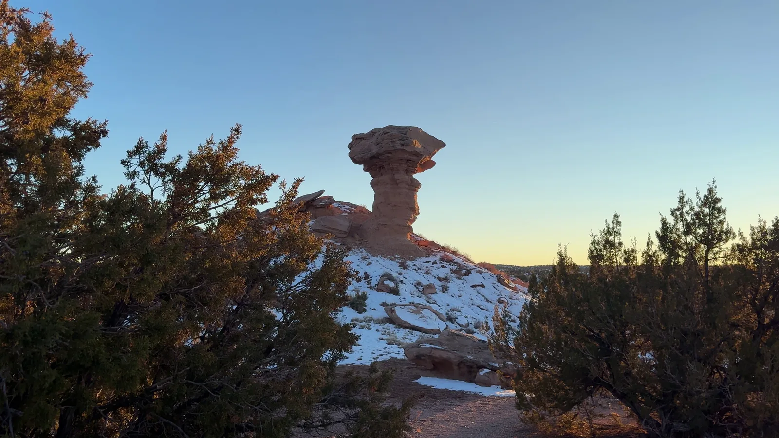
Camel Rock sits just north of Santa Fe on US 84/285, a sandstone formation that resembles a camel resting on the desert floor. It sits on Tesuque Pueblo land and has been a landmark for travelers heading north along the highway for generations.
What to Do
There isn’t much to “do” here beyond look and photograph — that’s the point. Camel Rock is visible right from the highway, and there’s a small parking area nearby where you can pull off for a closer look. A portion of the rock’s nose collapsed in 2017, but the formation still clearly resembles a camel. It’s especially photogenic in the morning and late afternoon, when the sandstone glows in warm shades of pink and orange.
How Much Time to Spend
Five minutes is enough. This is a quick photo stop, it’s not a destination in itself.
Getting There
Camel Rock sits right along US 84/285 north of Santa Fe, with a paved pullout for parking. Navigation is straightforward, you can’t really miss it if you’re driving this stretch of highway.
If you’re driving between Santa Fe and Taos or Española, it’s an easy five-minute stop that costs you nothing in time.
Related videos
Nearby places
Tesuque Pueblo
A small Tewa-speaking pueblo north of Santa Fe known for its artists and Camel Rock.
Nambe Falls
A waterfall on Nambe Pueblo flowing into a reservoir at the base of the Sangre de Cristo Mountains.
Santa Fe
The nation's oldest state capital, known for adobe architecture, world-class art, and a unique blend of Native, Hispanic, and Anglo cultures.