Place guide
Lybrook Badlands
Remote badlands in the San Juan Basin with towering hoodoos and fossil beds, and far fewer visitors than Bisti.
📍GPS: 36.192868, -107.597471
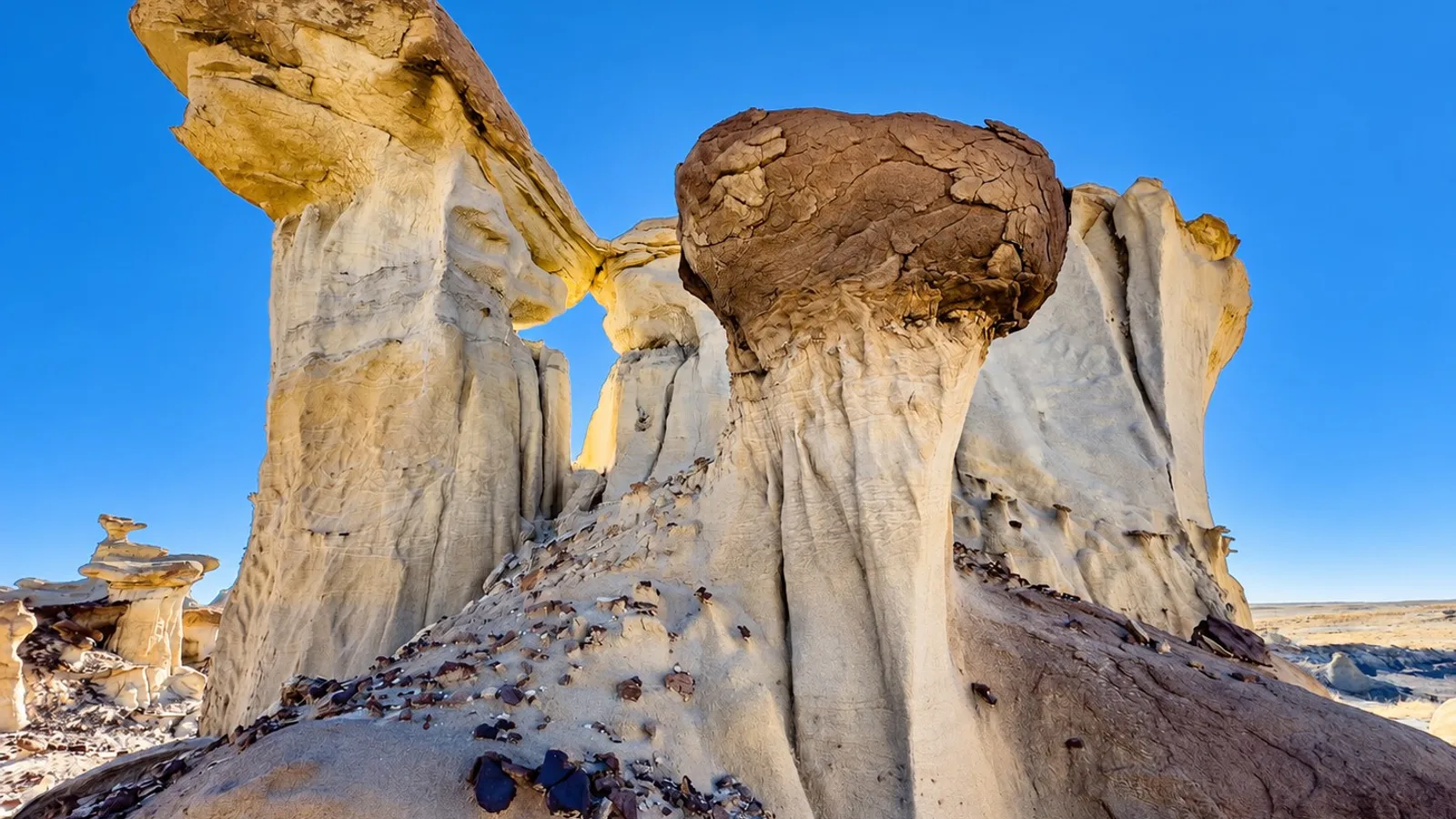
The Lybrook Badlands are a stretch of eroded hoodoos and clay hills in the San Juan Basin, spread across ten miles on either side of US 550 between Nageezi and Counselor. The BLM manages the land, but there are no facilities, no signed trails, and rarely visitors. The hoodoos are the main attraction. They’re taller and thicker than formations at Bisti.
What to Do
There are no marked trails. Visiting means walking through washes and among the hoodoo clusters, which are concentrated near the rim overlooks a couple of miles off US 550. Photography is the main activity, especially in the early morning or late afternoon. This is also a documented fossil area with petrified wood, leaves, and vertebrate fossils all having turned up.
How Much Time to Spend
A few hours is enough to explore the main hoodoo cluster and the rim overlooks near it. Dedicated photographers or hikers wanting to cover more of the ten-mile arc can easily spend a full day.
Getting There
From US 550, turn south onto paved road 7061 for about 5 miles, then east onto an unpaved track that crosses open clay flats. The track drops about 150 feet through a line of low cliffs after 3 miles, and a reasonable place to park near the hoodoos is another mile or two beyond that. A high-clearance vehicle is recommended for the unpaved stretch. If the clay is wet, come back another day. There’s no cell service and no shade, so bring extra water and a map.
Expect impressive hoodoo formations with almost no crowds, as long as you’re prepared for the remoteness!
Nearby places
Ah-Shi-Sle-Pah Wilderness
Remote, trail-less badlands near Nageezi with colorful hoodoos and Cretaceous fossil beds.
Chaco Culture National Historical Park
A UNESCO World Heritage Site containing the most sophisticated prehistoric buildings in North America.
Farmington
A gateway city in the Four Corners region surrounded by ancient ruins and excellent San Juan River fishing.