Place guide
Palisades Sill
A 300-foot dacite cliff towering over the Cimarron River, a striking roadside geology stop.
📍GPS: 36.537526, -105.152514
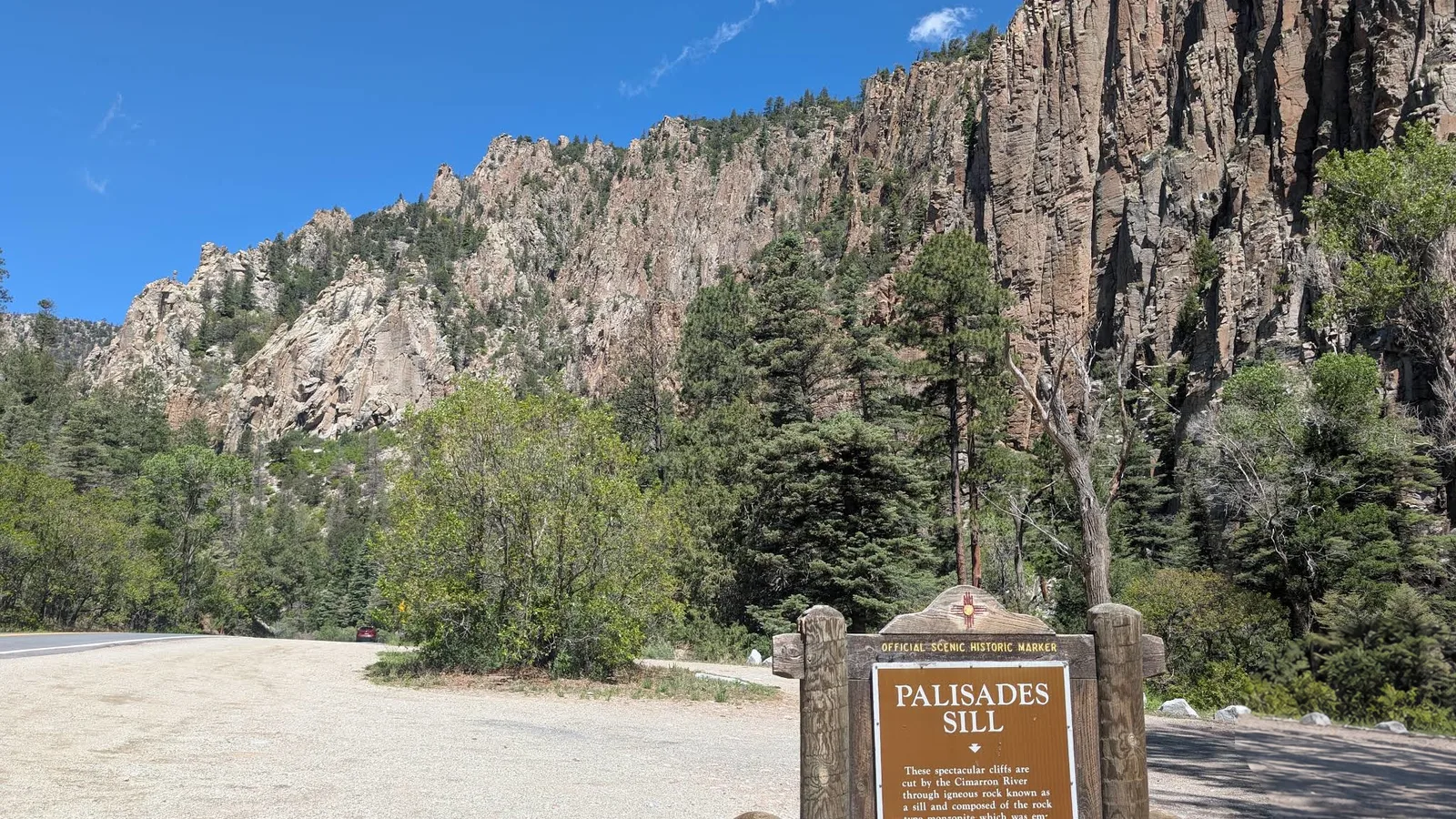
Palisades Sill is one of the most recognizable rock formations in Cimarron Canyon State Park, rising several hundred feet above the Cimarron River beside US-64. Its steep cliffs make it an easy photo stop along the Enchanted Circle Scenic Byway, especially if you’re already driving between Eagle Nest and Cimarron.
What to Do
The Palisades Sill is a large dacite rock face formed when magma pushed between older rock layers and cooled underground. Erosion later exposed the dramatic cliff face visible today. Pull into the Palisades Day Use Area for the closest views and interpretive signs explaining the geology. There isn’t a trail to the top, so this is mainly a sightseeing and photography stop. The Cimarron River also runs directly below the cliffs and is popular with fishermen.
How Much Time to Spend
About 15 minutes is enough to stop, read the signs, and take photos. If you’re fishing or having a picnic, plan on 30 to 45 minutes.
Getting There
The Palisades Day Use Area sits directly along US-64 in Cimarron Canyon State Park on the Enchanted Circle Scenic Byway. The parking area is just off the highway and easy to access.
If you’re already driving through Cimarron Canyon, Palisades Sill is worth a stop!
Nearby places
Cimarron Canyon State Park
A dramatic volcanic canyon carved by the Cimarron River, popular for fishing and rock climbing.
Eagle Nest Lake State Park
A high-altitude reservoir and wildlife area in the beautiful Moreno Valley near Angel Fire.
Red River
A lively ski town tucked in the Sangre de Cristo Mountains with year-round outdoor recreation.