Place guide
El Morro National Monument
A sandstone bluff covered with centuries of inscriptions from Puebloan, Spanish, and American travelers.
📍GPS: 35.039791, -108.351505
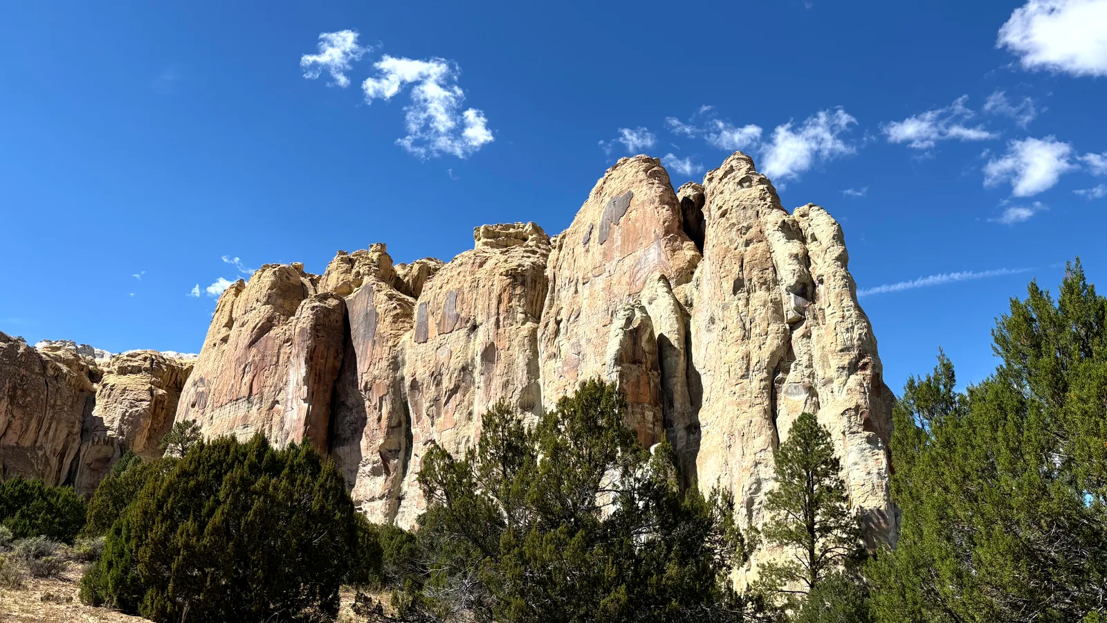
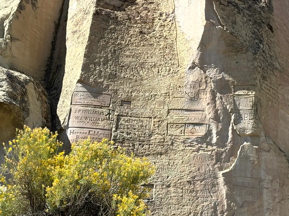
El Morro National Monument preserves a massive sandstone bluff where a thousand years of New Mexico history is literally written in stone. A permanent pool at the base of the cliff made El Morro an important stopping point for centuries. Puebloans lived on the mesa above, while later Spanish explorers, soldiers, settlers, and American travelers stopped for water and carved their names and messages into the soft sandstone. Today, roughly 2,000 inscriptions, petroglyphs, and pictographs cover portions of the rock face. The result is one of the most unusual historic sites in New Mexico: part archaeological site, part hiking destination, and part enormous outdoor guestbook!
What to Do
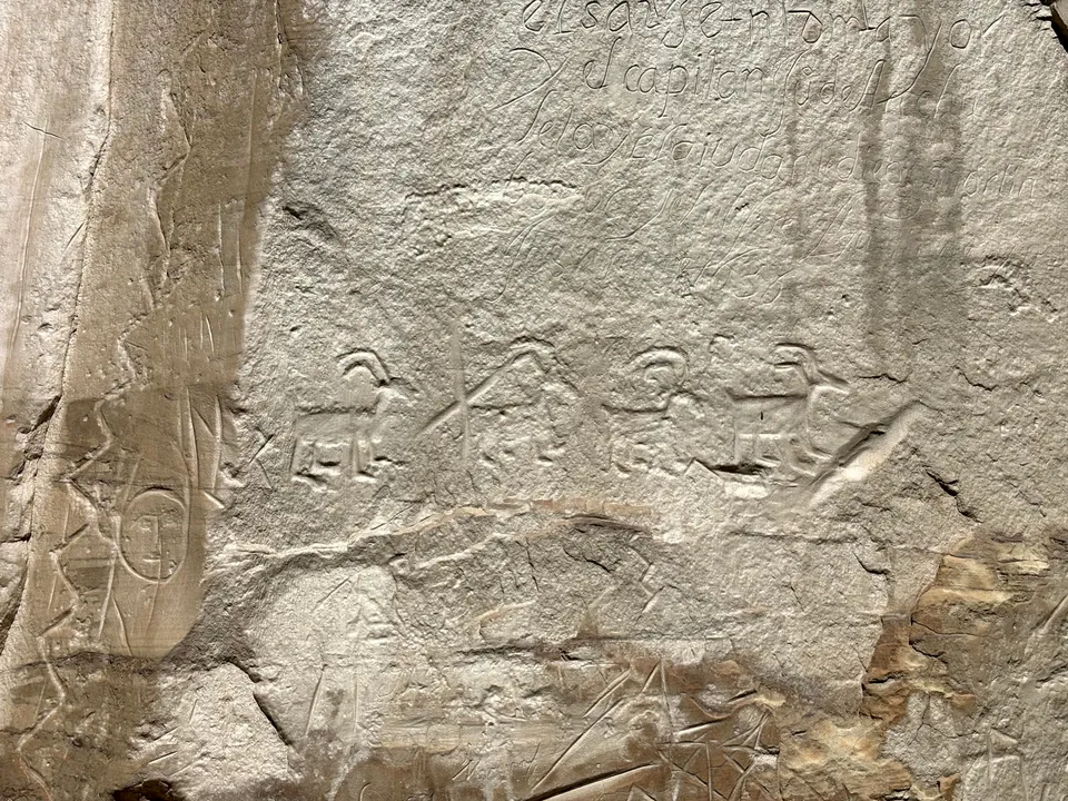
The easiest experience at El Morro is the 0.75-mile Inscription Loop Trail. It leaves from the visitor center and passes the historic pool and base of the bluff. Along the rock face are three eras of history: ancestral Puebloan petroglyphs, Spanish inscriptions, and American inscriptions.
See the Pool
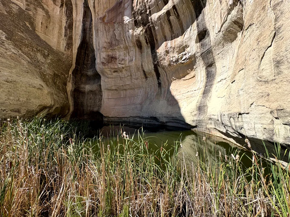
The small pool tucked beneath El Morro’s cliffs is the reason so many different groups passed through this exact spot. Rain and snowmelt collect naturally at the base of the sandstone, creating one of the desert’s few reliable sources of water for many miles. Without the pool, El Morro would never have accumulated its extraordinary collection of inscriptions.
Ancestral Puebloan Petroglyphs
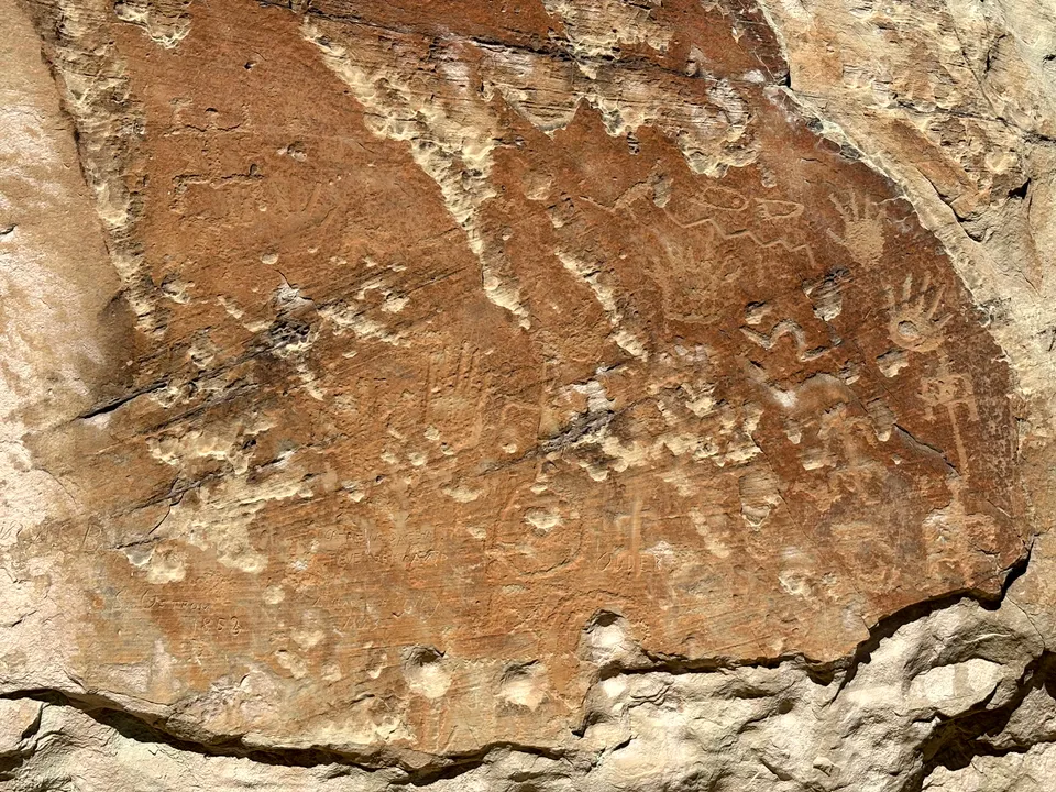
Atsinna Pueblo, on top of El Morro, was occupied for roughly 75 to 100 years. Archaeological evidence indicates it was established around 1275 CE and abandoned by about 1350, when its residents likely moved toward larger communities such as Zuni and Acoma. The petroglyphs left by the ancestral Puebloans depict animals, human figures, and abstract symbols, providing a glimpse into the lives and beliefs of the people who once inhabited the mesa top.
Spanish Inscriptions
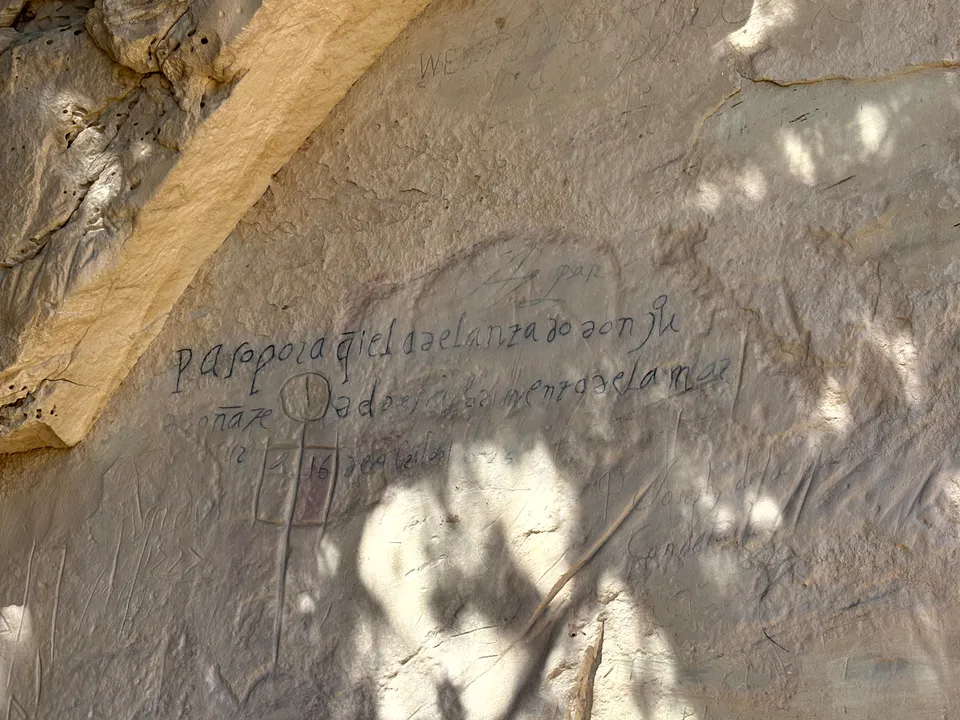
Lured by tales of golden cities, the Spanish began numerous expeditions into what is now New Mexico. The first Spanish inscription carved at El Morro is that of Governor Don Juan de Oñate in 1605; the last is dated 1774. These carvings included names, dates, and brief accounts of their travels.
American Inscriptions
From 1846-1906, United States military expeditions came to the area, followed by emigrants en route to California. Many of these Americans carved their names on the rock during this period, leaving behind a record of their presence and travels. In 1906, President Roosevelt designated El Morro as a national monument, ensuring the protection of its historic inscriptions and archaeological sites.
Atsinna Pueblo
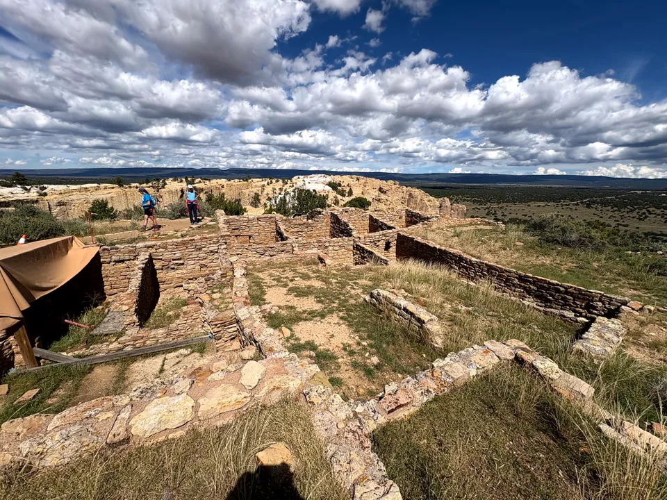
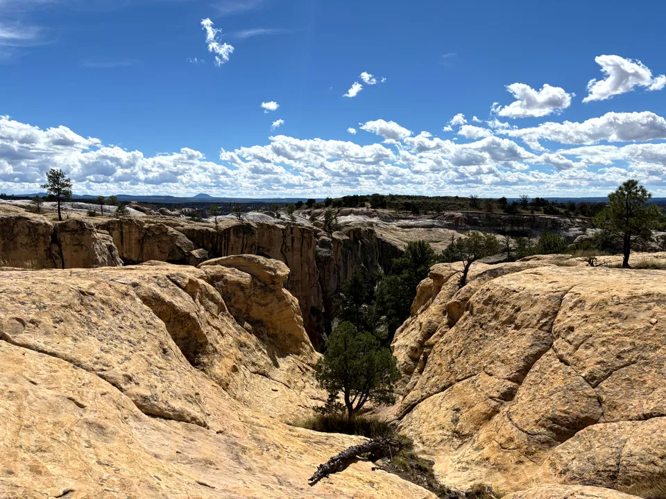
For the full experience, continue onto the Headland Trail, a roughly 2-mile loop that climbs to the top of El Morro. The trail gains about 224 feet and includes stairs, switchbacks, and long stretches across exposed sandstone.
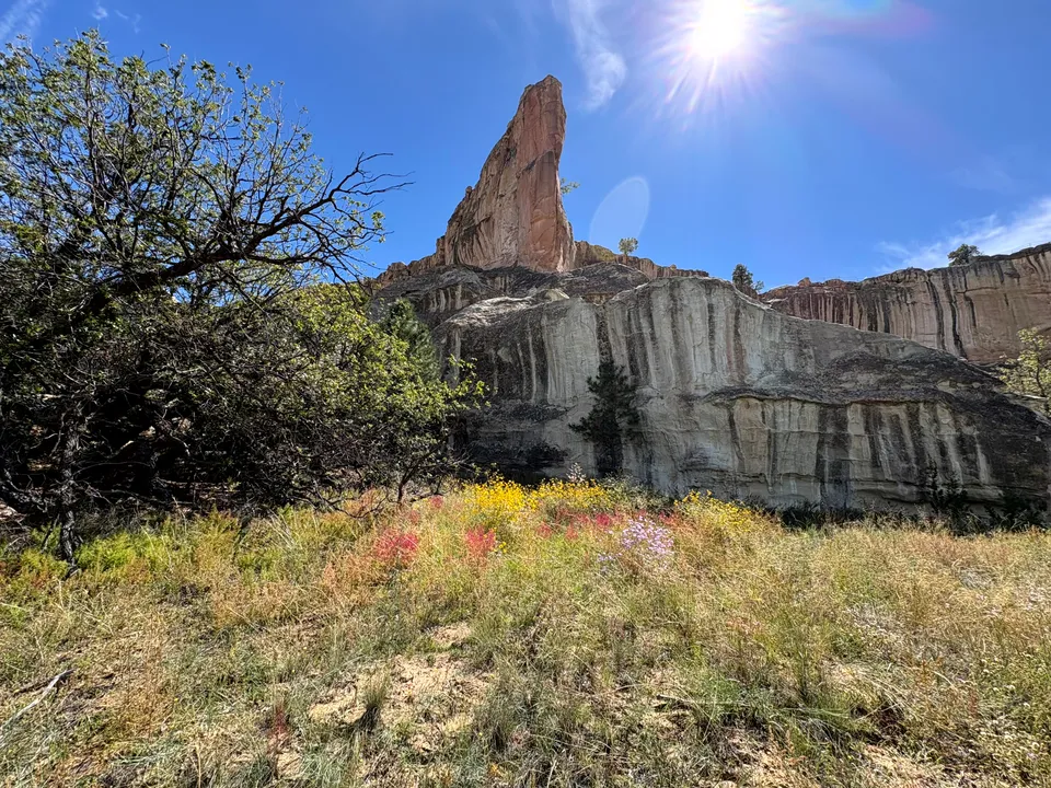
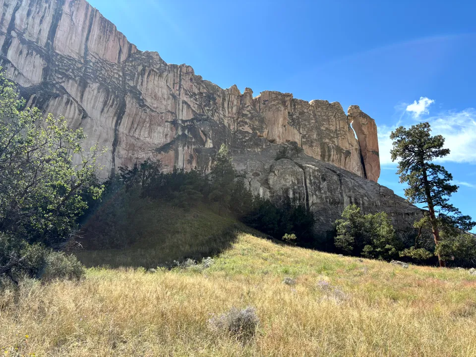
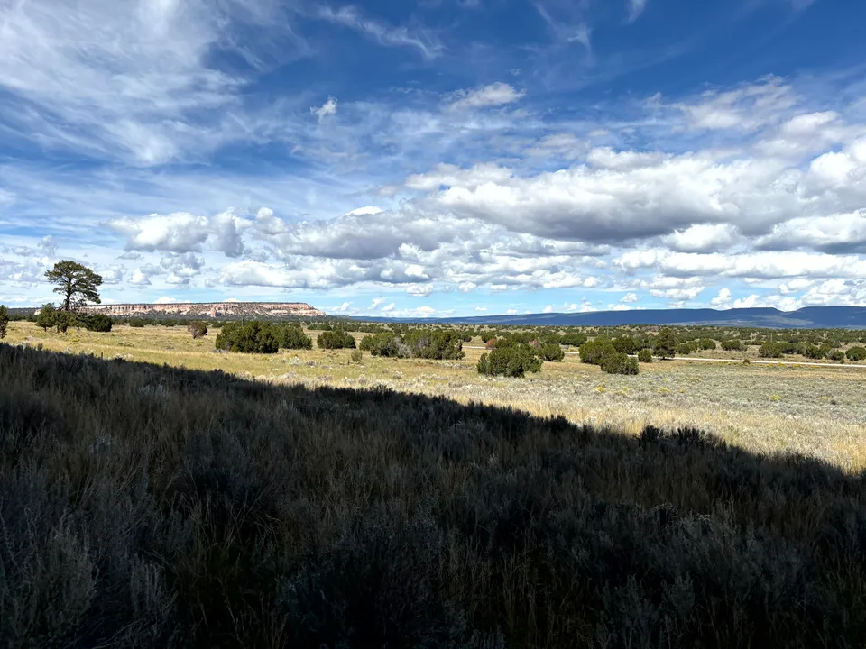
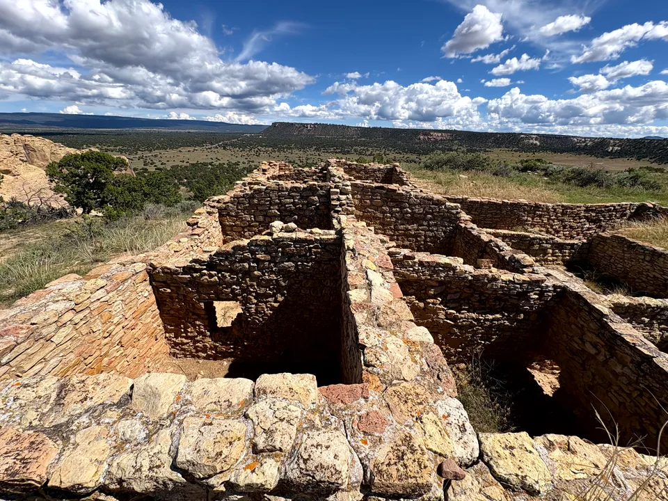
The mesa top provides broad views across the surrounding high-desert landscape and leads to Atsinna Pueblo, an ancestral Puebloan settlement constructed around 1275. The pueblo once contained roughly 355 rooms and may have housed several hundred people. Portions of the site have been excavated and stabilized, while much of the settlement remains buried beneath the mesa.
The combination of the petroglyphs below and the ancient pueblo above makes the Headland Trail well worth doing if you have the time.
Know Before You Go
Trail access is tied to visitor center hours, and the Headland Trail may close because of snow, ice, thunderstorms, or other weather conditions. Check current conditions before making the drive. Allow about an hour if you only want to see the pool and inscriptions. Give yourself two to three hours if you want to complete the Headland Trail and explore Atsinna Pueblo.
Getting There
El Morro National Monument sits along NM-53 in western New Mexico, about 45 miles southwest of Grants. The monument is easy to access, with the visitor center, trails, and main parking area all located just off the highway. El Morro pairs especially well with El Malpais National Monument and Zuni Pueblo. NM-53 connects the three areas across western New Mexico, making it easy to combine El Morro’s inscriptions and ruins with El Malpais’s lava fields and the cultural sites around Zuni in the same day or as part of a longer loop.
El Morro is an incredible destination for history buffs and hikers alike. Charles F. Lummis said it best in 1892, calling El Morro “the most precious cliff, historically, possessed by any nation on earth.”
Nearby places
Wild Spirit Wolf Sanctuary
A tourable sanctuary caring for wolves, wolfdogs, and other rescued wild and exotic animals.
Zuni Mountains
A forested mountain range known for a large multi-use trail network on old logging railroad grades and quiet stretches of Cibola National Forest.
Grants
A Route 66 town once known as the uranium capital of the world, gateway to El Malpais.